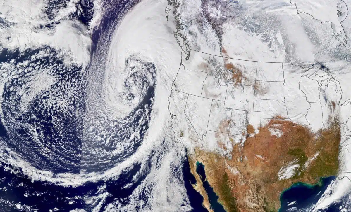
A powerful bomb cyclone and an intense atmospheric river are set to collide, unleashing a week of extreme weather across the Pacific Northwest and California. Expect hurricane-force winds, relentless rain, and staggering snow totals. Could this be the storm of the season?

The Pacific Northwest is preparing for a series of impactful weather systems this week, bringing powerful winds, heavy rainfall, and significant snowfall. This weather event includes a bomb cyclone and an atmospheric river, promising widespread effects across the region and parts of California.
A bomb cyclone, characterized by a rapid drop in air pressure (more than 60 millibars in 24 hours), is set to drive winds of up to 75 mph (120.7 km/h) across northern California, Oregon, and Washington starting Tuesday. These winds are expected to cause widespread power outages and tree damage.
Following this, an atmospheric river—a concentrated corridor of moisture—will sweep through California’s Redwood Coast and northern mountains. This will lead to:
- Rainfall totals: 5-10+ inches in some areas.
- Flooding and mudslides, particularly on Thursday as the system intensifies.
The National Weather Service has issued flood watches across regions like the Sacramento Valley, while urging residents to avoid travel in hazardous conditions.

Snowfall impacts in the Pacific Northwest and California
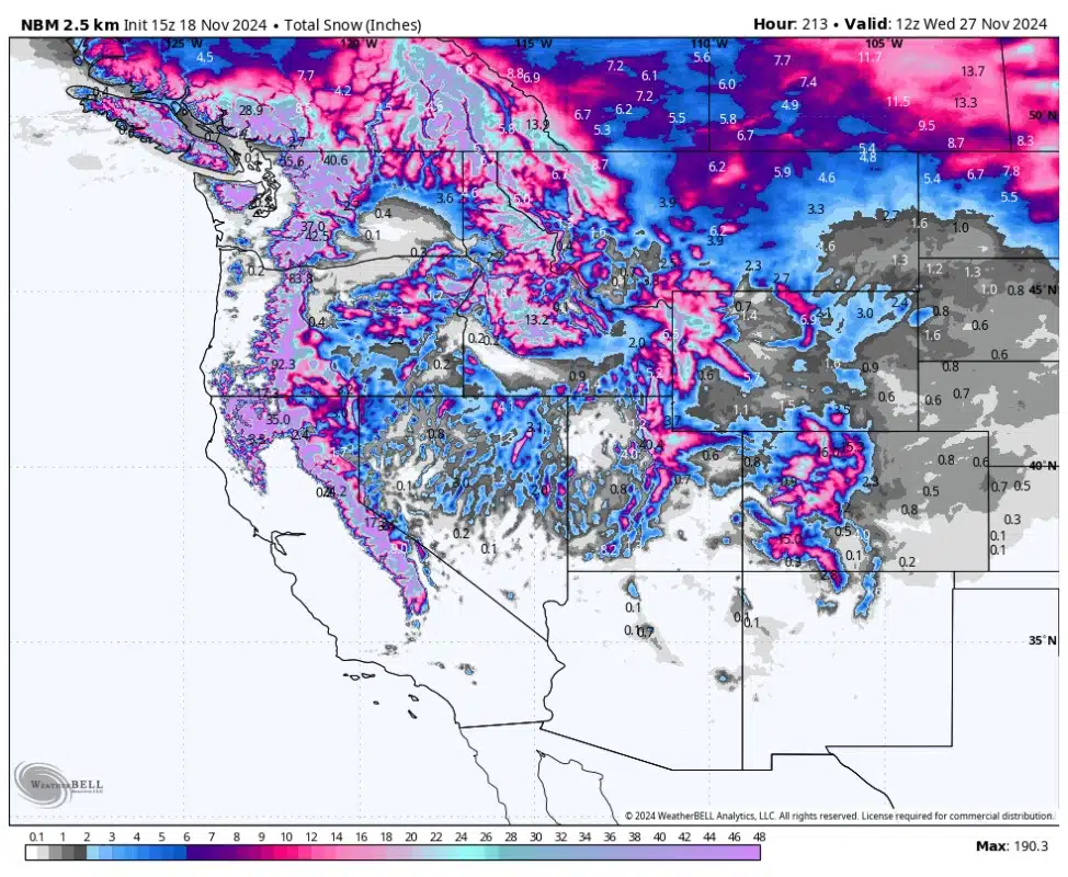
Pacific Northwest Summit Snowfall Totals (by November 24)
- Mt. Baker: 48-60
- Mt. Rainier: 55-80
- Mt. Hood: 40-60
Mid-Mountain Snowfall Totals (November 19-24)
- Crystal Mountain: 22-32
- Timberline: 20-34″
- Mt. Bachelor: 25-35
California Snowfall Totals (November 20-24)
Two systems will bring rain and snow to California, starting mid-week:
- November 20-21: Snow levels will rise from 5,000 feet (1.52 km) to 9,000 feet (2.74 km), turning snow into rain at many resorts:
- Palisades/Sugar Bowl: 6-12
- Kirkwood: 3-7″
- Mt. Rose: 1-3″
- November 22-24: A second storm will reverse the pattern, starting with rain and ending with snow as levels drop to 4,000 feet (1.22 km):
- Palisades/Sugar Bowl: 16-25
- Mammoth Mountain: 18-26

Broader effects across the West
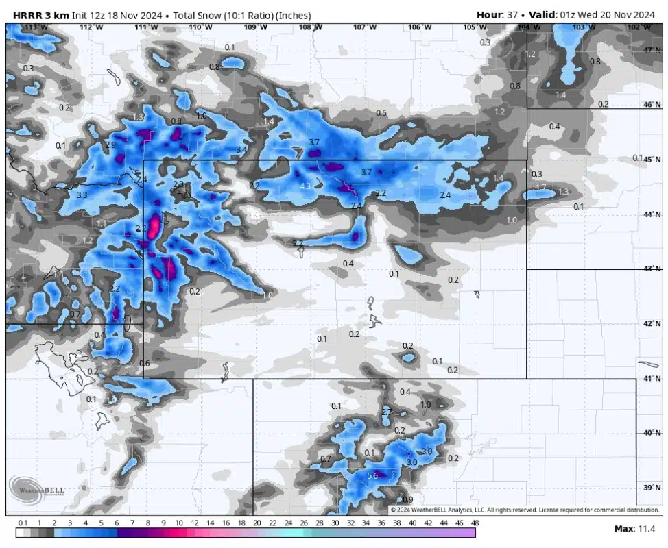
- Wyoming’s Tetons: Up to 12″ of snow.
- Northwestern Colorado: 2-6″ expected by Sunday.
- Utah: Snowfall starting Saturday, with accumulations of 25-35″ in the Cottonwoods by mid-week.
The third weather system could bring more than 10–20 inches of snow early next week to the Pacific Northwest and California as the storms progress. Residents and travelers should remain vigilant and follow updates as conditions evolve.

